Time flies with great content! Renew in to keep enjoying all our premium content.
Prime
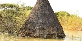
A hut at Roberts Camp Hotel submerged in Lake Baringo. FILE PHOTO | NMG
Radar science that was originally used in defence industry now has several applications in civilian and commercial realms.
Kenya can tap the technology to help mitigate problems such as floods.
Don't have an account? Register