Time flies with great content! Renew in to keep enjoying all our premium content.
Prime
Timely data will unlock farming potential, tech experts advise
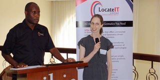
LocateIT managing director Erick Khamala with University of Sheffield’s Rose Pritchard during the AfriCultuRes workshop at the Crowne Plaza in Nairobi last week. PHOTO | SIMON LIBAFU
Earth observation scientists have identified the gap between the generation of vital agricultural data and timely access by smallholder farmers as the biggest impediment to food security in Kenya.
To address this challenge the European Union is funding a €8.5 million (Sh989.7 million) project– Enhancing Food Security and Agricultural Systems in Africa using Remote Sensing (AfriCultuReS) — that seeks to develop an information platform to boost farming and decision-making in the sector, targeting counties.
The AfriCultuReS consortium comprises 17 partners – eight from Africa and nine from Europe.
LocateIT Ltd, a space and geomatics company based in Nairobi, the local partner for the three-year project led by Spain-based company GMV, organised a user requirements workshop in Nairobi last Thursday that brought together earth observation experts, partners, downstream users and end users to chart the way forward for the development of an effective geo-based information system for the agricultural sector.
Managing director Erick Khamala said the project aims to develop a platform that would enable various users including the government, State agencies, research and academic institutions, private sector, NGOs as well as donors to tap into a rich database to make evidence-based decisions in the agricultural value chain.
“We want to decipher complex information from remote systems, package information in a simplified form to deliver key messages to end users such as farmers in the most appropriate and timely way,” he said.
“The project ambitions are big but we want to align the programme to benefit Kenya and make a difference in food production. We do not want to sit in the realm of technology. We want to make an impact on the society and support the Big Four agenda by ensuring the food security and nutrition pillar is well served using this technology.”
Rose Pritchard of UK-based University of Sheffield, the lead partner in user requirements assessment for the project, said the four-year project would also be implemented in Tunisia, Niger, Ghana, Rwanda, Ethiopia, Mozambique, South Africa and Kenya.
“There is a lot of different directions this could go to help farmers improve their yields, potentially increase their income as well,” she said on the sidelines of the workshop.
Mr Khamala added that earth observation data could also come in handy in achieving the other three priorities of the Big Four agenda.
“Farmers also need housing, their produce processed... We could also permeate into the three other pillars that are beyond food and nutrition,” he told the participants.
Agriculture PS for research and extension, Hamadi Boga said adopting smart technologies is the key to boosting efficient production.
“In Kenya, 18 million people depend on agriculture for their livelihood. So anything that can increase income for farmers we are committed to that as a government and I think we need to work together towards some of these objectives,” he told participants at the workshop.
Vihiga governor Wilber Ottichilo, whose county has been picked as a model in the use of geospatial data in the management of public affairs and resources, said he is keen on the technology because it is key to efficient food production and security.
The governor said these technologies could mitigate the problems the county and national governments face when planning for and disbursing subsidies, particularly fertiliser and certified seeds.
Currently, he said at the workshop, there is a lot of opaqueness in how beneficiaries are identified and the subsidies distributed.
The technologies would help map and register farmers, precisely derive farmed areas each season, and avoid “ghost farmers”.
“We can use it to change the mindset of farmers to shift from traditional agricultural systems to modern techniques,” Mr Ottichilo said.
Mr Khamala said the project had picked 12 counties for apilot in developing a county agricultural management information system and early warning and response information system for disaster response, crop and livestock insurance as well as outreach services.
The workshop participants included the Ministry of Agriculture, the World Bank, UN agency Food and Agriculture Organisation (FAO), Regional Centre for Mapping Resources for Development, Jubilee Insurance, Kenya Institute of Public Policy Research, Kenya Forestry Research Institute and East African Community’s Lake Victoria Basin Commission as well as other State agencies. They decried the disconnect between the technological systems in the agricultural sector.
“We know that drought is a major hazard in this country but every time it happens we always have mortalities and loss of food security situation,” said FAO geographic information systems (GIS) manager Joseph Matere.
“This will bring on board many other activities that will go a long way to help achieve the food security pillar.”
He added: “Sometimes we work at cross-purposes. I think that disconnect is what we can work to bridge here. We can have a situation where we could synergise all the players and minimise duplication. That convergence will bring our activities to better leverage on both upstream and downstream users, especially the ‘Wanjikus’. We want to save the animals, their livelihoods and food security at the household level.”
Egerton University faculty of engineering and technology dean Japheth Onyando said earth observation activities are too fragmented to the detriment of end users of the data gathered.
“I hope that at the end of the day we will find a way forward in which we can consolidate and mainstream our practices for effective use of our resources in developing geo-based data, which is dependent on GIS and remote sensing,” said Prof Onyando.
Unlock a world of exclusive content today!Unlock a world of exclusive content today!