Time flies with great content! Renew in to keep enjoying all our premium content.
Prime
IEBC faces controversial boundary reviews as Sh150m allocated for the exercise
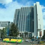
Article 89 of the constitution requires the commission to review names and boundaries of constituencies at intervals of not less than eight years and not more than 12. FILE PHOTO | NMG
The Independent Electoral and Boundaries Commission (IEBC) has been allocated over Sh150 million in the Supplementary Budget II to start the process of delimitation of electoral boundaries ahead of the 2022 general election.
Article 89 of the constitution requires the commission to review names and boundaries of constituencies at intervals of not less than eight years and not more than 12.
Further, the commission is mandated to review the number, names and boundaries of wards periodically.
But the number of constituencies must be maintained at 290 as stated in the constitution.
The last delimitation or fixing the boundary was conducted in 2012, meaning that the commission can still conduct the exercise by 2024.
With any review to be completed at least 12 months before a general election of Members of Parliament, IEBC has a tight schedule if it has to complete the process before the 2022 general election.
“If a general election is to be held within12 months after the completion of a review by the Commission, the new boundaries shall not take effect for purposes of that election,” reads Article 89 (4) of the constitution.
But how the electoral body will go about the process, given the sensitivity of the matter, remains a big challenge.
This is because a number of counties and its leaders have been wrangling for years over territorial boundaries.
Early this year, IEBC chairman Wafula Chebukati announced that the commission had developed the Boundaries Review Operations Plan (BROP) and that it was set to start implementing it.
But this stalled due to the outbreak of coronavirus, which prevented the commission’s officials from going round the country to gather views and lack of budgetary allocation.
But with the funds having been allocated through supplementary budget, IEBC is ready to go on with the process.
According to IEBC, it will use the official census data from the Kenya National Bureau of Statistics (KNBS), and the 2019 population and housing census results, to guide the review of electoral wards.
While reviewing the boundaries, IEBC is required to take into account the geographical features and urban centres, community of interest, historical, economic, and cultural ties and means of communication.
The 2019 Population and Housing Census results showed that there are 47.6 million Kenyans and the population quota per constituency is likely to rise to approximately 164,000 with exceptions for cities and sparsely populated areas.
This means that constituencies that do not meet the population quota may be scrapped.
In adherence to Article 89 on the number of constituencies, the IEBC may resort to transferring some wards from sparsely populated areas to those with less population quotas.
The alteration of ward boundaries may only be done according to the procedure set out in Article 188 of the Constitution.
County boundaries may only be altered through a resolution recommended by an independent commission set up for that purpose by Parliament and passed by the National Assembly and the Senate with the support of at least a two-thirds majority by the members of the Assembly and county delegations respectively.
The IEBC (Amendment) Bill, 2020 – which seeks to amend section 36 of the parent Act to guide the delimitation of electoral boundaries, is yet to be enacted. There has been simmering tensions between a number of communities and counties over electoral boundaries.
In 2016, residents of Isiolo moved to court seeking to stop a boundary dispute committee set up by the Ministry of Interior. In the petition, the communities accused the government of hand-picking the committee to adjudicate on the Meru/Isiolo boundary row.
After hearing their case, Justice Isaac Lenaola, then a High Court judge agreed with the residents and quashed the committee.
The crux of the matter was a boundary dispute between Isiolo and Meru counties, which the residents said was a historical matter, dating back to 1924. The elders from Isiolo said this was the year the boundary between two neighbouring counties was erroneously marked.
The elders and professionals told the court that they were never invited to participate in the boundary discussions during the proceedings of the Boundary Commission of 1962 due to the secessionist’s war with Somalia.
Consequently, the indigenous communities living in the region covering the county of Isiolo have persistently sought a new boundary survey on the common boundaries between Isiolo and Meru to verify and correct what they termed historical injustices.
And over the years, there have been persistent attacks, arising from the differences between communities living in Isiolo and Meru counties.
The tension allegedly escalated with the launch of the Vision 2030 projects such as Isiolo International Airport, the Lamu Port-South-Sudan-Ethiopia Transport (LAPSSET) Corridor and the Isiolo Resort City.
In his judgement, Justice Lenaola said while the government has the mandate to set up any committee within the law, the Interior Secretary then, had no mandate to set up a committee to alter or demarcate the boundaries of Isiolo and Meru counties.
A similar dispute had been filed almost the same time by Turkana County government and professionals from the area. But a Bench of three judges rejected an invitation by Turkana County todeclare West Pokot and Baringo counties as having violated its territorial integrity.
The judges ruled that the matter was not for court to determine but Parliament and the Executive.
Other than the boundary dispute, the Turkana County wanted national government to provide them with security so that they could ward off raiders who threatened their “territorial integrity”.
It was also their argument that the then provincial administration had created “administrative units” within Turkana County belonging to or considered to be part of neighbouring counties. They claimed in the process, the national government unlawfully transferred resources belonging to Turkana County to neighbouring counties.
These resources included Turkwel Gorge Plant, which they claimed was illegally transferred to Baringo County and the forcible removal or eviction of the residents of Kapedo, Nadome, Lomelo Napeiton, Kaseitet, Nasekol, Akoret, Naiserewa, Turkwel Gorge, Nasolot, Komalamarukon and Lokankapei.
Other areas constantly affected by raiders included Koikalale, Angiolgitai, Lochakula, Tegeit, Laiterik, Turkana South Reserve, Kogito and River Turkwel.
Apart from Turkana, Baringo, West Pokot as well as Isiolo and Meru Counties, there are a host of other counties which have accusing each other of encroachment.
They include Vihiga and Kisumu, which have been fighting over the location of Maseno township, which is claimed by both; Kisii and Nyamira counties which are wrangling over revenue collection in Keroka town; Makueni and Machakos county governments, with both claiming Konza, where the government is building a techno city.
Bungoma and Busia have also been quarrelling and a similar dispute has been simmering between Nandi and Kisumu counties.
Soon after assuming power, Nandi Governor Stephen Sang’ sparked a controversy when he said he would present a petition to IEBC and the National Lands Commission to adjust the county’s borders to have Miwani, Kibos, Kibigori, Kopere, Chemelil and Muhoroni, which are in Kisumu, to Nandi County.
Apart from tensions between the counties, IEBC will also have to address the matter of some 26 constituencies, which did not meet the population criteria after the review in 2012.
The constituencies include Othaya, Ndaragwa, Tetu, Mukurweini, Kangema and Mathioya in Mount Kenya region. In the Coast region, those that did not meet the quota in the last review are Lamu East, Lamu West, Mvita, Mwatate, Wundanyi, Voi, Bura and Galole.
Others are Samburu East, Marakwet East, Keiyo North, Mogotio in the Rift Valley and Vihiga and Budalang’i in Western as well as Laisamis, Isiolo South, Kilome, North Horr, Saku, and Mbeere North in eastern.
The law provides that the population of a constituency must be higher or lower than its quota by 40 per cent for cities and sparsely populated areas, and 30 percent for other areas.
The quota is arrived at by dividing the total population by the 290 constituencies. After the 2019 census, this calculation will be based on its figure of 47.6 million Kenyans.
Unlock a world of exclusive content today!Unlock a world of exclusive content today!